When Maps Lie: How Data Poisoning Attacks Are Weaponizing Geospatial AI
When Maps Lie: How Data Poisoning Attacks Are Weaponizing Geospatial AI
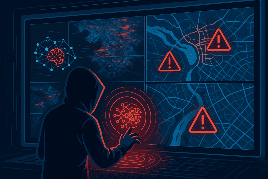
The digital revolution has transformed how we navigate, plan, and understand our world through artificial intelligence-powered geospatial systems. From autonomous vehicles relying on GPS coordinates to smart cities optimizing traffic flow through satellite imagery analysis, spatial AI has become the invisible backbone of modern civilization. However, a sinister threat is emerging that could undermine the very foundation of our trust in digital maps and location-based services: geospatial data poisoning.
Unlike traditional cyberattacks that target computer networks, data poisoning attacks contaminate the information that AI systems learn from—corrupting their understanding of reality itself. When applied to geospatial data, these attacks can literally rewrite the digital representation of our physical world, creating false realities that AI systems accept as truth.
The Anatomy of Geospatial Data Poisoning
Understanding the Fundamental Vulnerability
Data poisoning represents a sophisticated adversarial attack that targets the training datasets used by machine learning models. In the geospatial context, this means injecting malicious information into satellite imagery, GPS coordinates, mapping databases, or sensor networks that spatial AI systems rely on for decision-making.
The attack mechanism is deceptively simple yet devastatingly effective: attackers introduce carefully crafted false data into training datasets, causing AI models to learn incorrect patterns and make flawed predictions. Unlike traditional malware that attacks code, data poisoning corrupts the very knowledge base that AI systems use to interpret the world.
The Geospatial Attack Surface
Modern geospatial AI systems present multiple attack vectors for malicious actors:
Satellite Imagery Manipulation: Advanced techniques using Generative Adversarial Networks (GANs) can create synthetic satellite images that are virtually indistinguishable from authentic ones. These “deepfake” satellite images can add non-existent buildings, roads, or geographical features to fool AI systems analyzing infrastructure and urban development.
GPS and Navigation Data Corruption: Attackers can inject false location coordinates, route information, or traffic patterns into navigation databases, causing AI-powered routing systems to make dangerous or inefficient decisions.
Sensor Network Compromise: Smart city IoT sensors collecting environmental, traffic, or infrastructure data can be fed manipulated information that propagates through entire urban management systems.
Training Dataset Infiltration: Research databases containing geospatial information used to train AI models can be systematically corrupted with subtle but pervasive inaccuracies.
Real-World Attack Scenarios and Case Studies
The Deepfake Geography Phenomenon
Researchers at the University of Washington demonstrated the alarming ease with which satellite imagery can be manipulated using AI techniques. Their study showed how GANs could generate fake cityscapes by blending features from different real cities, creating convincingly false visuals of nonexistent urban environments that could fool both human analysts and AI systems.
Todd Myers from the National Geospatial-Intelligence Agency warned that adversaries, particularly state actors, are already using these techniques operationally: “The Chinese are well ahead of us. They’re already doing it right now, using GANs to manipulate scenes and pixels to create things for nefarious reasons”.
A practical example involved creating fake satellite imagery showing a bridge crossing a river where none existed. Military or civilian operations relying on this corrupted intelligence could plan routes to non-existent infrastructure, potentially resulting in mission failure or physical danger.
Transportation and Navigation Attacks
Recent research documented sophisticated GPS spoofing attacks against autonomous vehicles, where attackers gradually manipulate position data to lead vehicles off their intended routes. These “slow drift” attacks are particularly dangerous because they:
- Maintain strong correlation with legitimate signals (R² values between 0.99 and 1.0), making detection extremely difficult
- Gradually deviate from correct routes, avoiding sudden changes that might trigger security systems
- Exploit vehicle turning maneuvers, when GPS reliability naturally decreases, to maximize attack effectiveness
The implications extend beyond individual vehicles. Research on autonomous ride-hailing fleets demonstrated that strategically placed spoofing devices could cause systematic service degradation across entire transportation networks. Even a limited number of attack points could significantly increase travel delays and cause passengers to be dropped at incorrect destinations.
Critical Infrastructure Vulnerabilities
The threat to critical infrastructure through geospatial data poisoning became starkly evident in recent attacks on industrial control systems. CISA documented 29 attacks on US critical infrastructure between November 2023 and April 2024, many involving manipulation of geographic and operational data used by industrial control systems.
In one documented case, attackers compromised Trimble Cityworks GIS-centric asset management software (CVE-2025-0994), which is used by municipalities to manage infrastructure assets through geospatial data. The vulnerability allowed remote code execution, potentially enabling attackers to manipulate critical infrastructure mapping and operational data.
Smart City Attack Vectors
Smart cities represent particularly attractive targets due to their extensive reliance on geospatial data for operations. Documented vulnerabilities include:
Traffic Management Manipulation: Attackers can poison traffic pattern data used by AI optimization systems, causing deliberate congestion or routing citizens through unsafe areas.
Emergency Response Disruption: Corrupted location data for emergency services could delay response times or misdirect first responders during critical incidents.
Environmental Monitoring Deception: False environmental sensor data could mask pollution incidents, interfere with disaster response, or trigger unnecessary evacuations.
Technical Deep Dive: Attack Methodologies
Generative Adversarial Networks in Geographic Deception
Modern data poisoning attacks leverage sophisticated AI techniques, particularly Generative Adversarial Networks (GANs), to create convincing but false geospatial data. The process involves:
Training Data Generation: GANs learn patterns from legitimate satellite imagery, GPS traces, or sensor data to understand normal characteristics.
Adversarial Synthesis: The system generates synthetic data that maintains statistical properties of authentic data while introducing specific false information.
Steganographic Integration: False data is embedded within legitimate datasets using techniques that make detection extremely difficult.
Research has demonstrated that even sophisticated detection systems struggle to identify high-quality synthetic geospatial data, particularly when attackers use Cycle-Consistent Adversarial Networks (CycleGAN) techniques specifically adapted for satellite imagery.
Multi-Stage Infiltration Strategies
Advanced attackers employ multi-stage infiltration techniques that gradually corrupt geospatial AI systems over time:
Initial Seeding: Small amounts of poisoned data are introduced into training datasets, below detection thresholds.
Pattern Reinforcement: Additional corrupted data reinforces false patterns, strengthening the AI system’s incorrect understanding.
Operational Exploitation: Once the AI system has learned false patterns, attackers can trigger predictable incorrect behaviors in operational environments.
Cross-Modal Attack Vectors
Modern geospatial AI systems often combine multiple data types—satellite imagery, sensor readings, GPS coordinates, and textual descriptions. Attackers exploit this complexity through cross-modal poisoning, where corruption in one data type affects the system’s interpretation of other data types.
For example, corrupted satellite imagery showing false infrastructure might cause an AI system to incorrectly interpret legitimate GPS coordinates or sensor readings from the same area.
Business and Societal Impact
Economic Consequences
The potential economic impact of geospatial data poisoning attacks extends far beyond immediate technical damage:
Transportation and Logistics Disruption: According to industry analysis, GPS spoofing incidents surged by 500% in 2024, with significant impacts on aviation, shipping, and ground transportation. Each incident potentially affects thousands of vehicles and millions of dollars in cargo and passenger operations.
Infrastructure Investment Waste: Cities and organizations making infrastructure decisions based on corrupted geospatial data could invest billions in unnecessary or counterproductive projects.
Insurance and Liability Issues: Autonomous vehicle accidents caused by navigation data poisoning could result in complex legal battles over liability between manufacturers, data providers, and attack victims.
National Security Implications
Government agencies have identified geospatial data poisoning as a critical national security threat:
Military Operations: False satellite imagery or geographic intelligence could misdirect military operations, potentially resulting in mission failure or unnecessary casualties.
Critical Infrastructure Protection: Attacks on power grids, water systems, and transportation networks could be facilitated or concealed through corrupted geospatial monitoring data.
Intelligence Gathering: Foreign adversaries could use synthetic satellite imagery to mask military installations or industrial activities from surveillance systems.
Public Safety Risks
The human cost of geospatial data poisoning attacks could be severe:
Emergency Response Failures: Corrupted location data during natural disasters or emergency incidents could delay or misdirect first responders.
Transportation Accidents: GPS spoofing attacks on autonomous vehicles have demonstrated the potential for causing traffic accidents through navigation manipulation.
Healthcare System Disruption: Location-based medical services could be compromised, affecting ambulance routing, medical supply logistics, or patient tracking systems.
Advanced Defense Strategies
Multi-Source Data Validation
Effective defense against geospatial data poisoning requires comprehensive validation frameworks that verify data integrity across multiple sources:
Cross-Reference Verification: Compare geospatial data from multiple independent sources to identify discrepancies that might indicate poisoning attempts.
Temporal Consistency Analysis: Monitor data changes over time to detect sudden or unrealistic modifications that could indicate malicious manipulation.
Statistical Anomaly Detection: Implement machine learning systems specifically designed to identify statistical patterns consistent with data poisoning attacks.
Blockchain and Distributed Ledger Technologies
Several organizations are exploring blockchain-based solutions for ensuring geospatial data integrity:
Immutable Data Records: Store critical geospatial data in blockchain systems that make unauthorized modifications easily detectable.
Provenance Tracking: Maintain detailed records of data sources, modifications, and validation steps for all geospatial information.
Consensus Mechanisms: Use distributed validation systems where multiple parties must agree on data authenticity before it’s accepted into operational systems.
AI-Powered Defense Systems
Advanced detection systems leverage artificial intelligence to identify sophisticated data poisoning attempts:
Adversarial Training: Train AI models using known poisoning techniques to improve their resistance to future attacks.
Ensemble Detection Methods: Deploy multiple AI models with different architectures to cross-validate geospatial data and identify inconsistencies.
Real-Time Monitoring Systems: Implement continuous monitoring of geospatial data streams to detect anomalies or manipulation attempts as they occur.
Hardware-Based Security Measures
Physical security measures provide additional protection against geospatial data manipulation:
Secure GPS Receivers: Deploy military-grade GPS systems with encryption and authentication capabilities that resist spoofing attacks.
Sensor Tamper Detection: Implement hardware security modules in IoT sensors that detect physical tampering or unauthorized data modification.
Network Segmentation: Isolate critical geospatial systems from general network infrastructure to limit attack propagation.
Industry Response and Regulatory Developments
Government Initiatives
Federal agencies are developing comprehensive strategies to address geospatial data poisoning threats:
CISA Guidelines: The Cybersecurity and Infrastructure Security Agency has published specific guidance for protecting critical infrastructure against data poisoning attacks, with particular emphasis on geospatial systems.
National Geospatial-Intelligence Agency Programs: NGA is investing in research and development of detection technologies specifically designed to identify synthetic and manipulated geographic data.
International Cooperation: Government agencies are working with international partners to share threat intelligence and develop coordinated response strategies.
Private Sector Solutions
Technology companies are developing commercial solutions to address geospatial data poisoning:
Microsoft Security Solutions: Microsoft has implemented advanced detection capabilities in its geospatial AI products, including real-time monitoring for data integrity violations.
Google Earth Intelligence: Google’s Earth Engine platform incorporates multiple validation layers to detect and filter potentially corrupted satellite imagery.
Specialized Security Firms: Companies like Geograma are offering dedicated “SafeGIS” services that provide continuous monitoring and threat intelligence for geospatial systems.
Academic Research Initiatives
Universities worldwide are conducting cutting-edge research on geospatial data poisoning defense:
Detection Algorithm Development: Research institutions are developing new mathematical and AI-based approaches for identifying subtle data manipulation.
Forensic Analysis Techniques: Academic teams are creating tools for analyzing suspected data poisoning incidents and attributing attacks to specific threat actors.
Ethical Framework Development: Researchers are establishing guidelines for responsible disclosure of geospatial vulnerabilities and ethical testing methodologies.
Future Threats and Emerging Risks
AI-Powered Attack Evolution
As AI technology continues advancing, geospatial data poisoning attacks are becoming increasingly sophisticated:
Automated Attack Generation: AI systems capable of automatically generating large-scale, coordinated data poisoning campaigns targeting multiple geospatial databases simultaneously.
Context-Aware Manipulation: Advanced attacks that understand the operational context of target systems and craft poisoning attempts specifically designed to cause maximum disruption.
Multi-Modal Synthesis: Integration of deepfake video, synthetic audio, and false documentation to create comprehensive false realities that support geographic deception.
Internet of Things Proliferation
The explosive growth of IoT devices in smart cities and infrastructure creates new attack surfaces:
Sensor Network Compromise: Attackers gaining control of large networks of environmental, traffic, or infrastructure sensors to inject false data at scale.
Edge Computing Vulnerabilities: AI processing occurring closer to data sources creates new opportunities for real-time data manipulation.
5G Network Exploitation: High-speed networks enabling more sophisticated and coordinated attacks on geospatial data streams.
Quantum Computing Implications
The eventual development of practical quantum computing systems could revolutionize both attack and defense capabilities:
Cryptographic Vulnerabilities: Quantum computers could potentially break current encryption systems protecting geospatial databases.
Advanced Synthesis Capabilities: Quantum-powered AI could create synthetic geospatial data of unprecedented realism and sophistication.
Detection Enhancement: Conversely, quantum computing could enable new detection methods capable of identifying currently undetectable data poisoning attacks.
Organizational Preparedness and Best Practices
Risk Assessment Framework
Organizations must develop comprehensive risk assessment procedures specifically for geospatial data poisoning:
Asset Inventory: Catalog all geospatial data sources, AI systems, and decision-making processes that could be affected by data poisoning.
Threat Modeling: Identify specific attack scenarios relevant to organizational operations and assess their potential impact.
Vulnerability Assessment: Regular testing of geospatial AI systems against known data poisoning techniques.
Incident Response Planning
Effective incident response requires specialized procedures for geospatial data poisoning incidents:
Detection Protocols: Establish automated and manual processes for identifying potential data poisoning incidents.
Containment Strategies: Develop procedures for isolating affected systems and preventing attack propagation.
Recovery Procedures: Create frameworks for validating and restoring corrupted geospatial data while maintaining operational continuity.
Staff Training and Awareness
Human factors remain critical in defending against geospatial data poisoning:
Technical Training: Ensure IT and GIS staff understand data poisoning attack vectors and defensive measures.
User Education: Train end users to recognize signs of potentially corrupted geospatial data or system behavior.
Cross-Functional Collaboration: Develop communication protocols between cybersecurity, GIS, and operational teams.
Conclusion: Securing Our Spatial Future
Geospatial data poisoning represents a fundamental challenge to our increasingly AI-dependent spatial intelligence infrastructure. Unlike traditional cyberattacks that damage systems, these attacks corrupt the very knowledge that AI systems use to understand and navigate our world. The implications extend far beyond technical vulnerabilities—they threaten the foundation of trust in digital maps, autonomous vehicles, smart city services, and critical infrastructure management.
The evidence is overwhelming: GPS spoofing incidents increased by 500% in 2024, sophisticated deepfake satellite imagery can fool both human analysts and AI systems, and nation-state actors are already weaponizing these techniques for strategic advantage. Meanwhile, our critical infrastructure remains vulnerable, with documented attacks on water systems, transportation networks, and municipal services demonstrating the real-world impact of these threats.
The technical sophistication of attacks continues to evolve, with adversaries leveraging advanced AI techniques like GANs to create synthetic geospatial data that is virtually indistinguishable from authentic information. Traditional security measures designed for protecting computer networks are inadequate against threats that exploit the fundamental learning processes of AI systems.
However, hope exists in emerging defense strategies that combine multi-source validation, blockchain technology, AI-powered detection systems, and hardware-based security measures. Organizations that implement comprehensive defense-in-depth approaches can significantly reduce their vulnerability to geospatial data poisoning attacks.
The path forward requires immediate action across multiple fronts:
- Government agencies must accelerate development of detection standards, threat intelligence sharing, and regulatory frameworks specifically designed for geospatial AI security
- Technology companies must integrate security considerations into the fundamental design of geospatial AI systems rather than treating them as afterthoughts
- Organizations must implement comprehensive risk assessment and incident response procedures tailored to the unique challenges of spatial data integrity
- Research institutions must continue developing advanced detection techniques and ethical frameworks for responsible vulnerability disclosure
The stakes could not be higher. As we build increasingly autonomous and AI-dependent systems for transportation, urban management, emergency response, and critical infrastructure, the integrity of our geospatial data becomes a matter of life and death. The future of smart cities, autonomous vehicles, and AI-powered civilization depends on our ability to distinguish between authentic and malicious spatial information.
Organizations that fail to address geospatial data poisoning risks face not only operational disruption and financial losses but potentially catastrophic consequences for public safety and national security. Conversely, those that proactively implement robust defenses will gain competitive advantages through improved reliability, regulatory compliance, and stakeholder trust.
The digital transformation of our physical world through spatial AI represents one of the most significant technological shifts in human history. Whether this transformation enhances or endangers our civilization depends largely on our collective ability to secure the geospatial data that makes it possible. The time for action is now—before the maps we depend on lead us into danger.
Organizations seeking to assess their geospatial AI security posture should immediately conduct comprehensive audits of their spatial data sources, implement multi-source validation systems, and prepare incident response procedures specifically designed for data poisoning attacks. The future of spatial intelligence depends on the security measures we implement today.


Responses